


Wanda's Adventures: Xat'sul Heritage Village (pt. 3)
One of my favourite things about road trips is randomly changing my route because I saw something on a sign along the highway. It is a particular joy to know I always have my bed with me, so I just need a place to park. It suits my meandering ways.
I had left my overnight stop at Lac La Hache Provincial Park and carried on north along the Cariboo Highway, passing some First Nations land and “Mile House” hamlets and towns, but mainly I drove past a lot of ranches and caught few peeks of winding roads going in completely the wrong direction.

I made a fuel stop at 150 Mile House at a full-service truck stop. In the 1880s, 150 Mile House (named because it was 150 miles from the start of the Cariboo Wagon Road) was a bustling town.

Nearby the truck stop was a cute little schoolhouse. It was built in the 1890s and used until a new school was built in 1959. This schoolhouse was built by the local community after being frustrated at the lack of funding from the provincial government. It wasn’t open for the public, as it is used by the local school district for various classes on the history of the area.

I got back on the road and noticed a sign indicating that the exit for Xat’sull Historic Village was coming up. One of my goals for his trip is to learn more about indigenous perspectives about the rich settler history of this province. Much of the history I learned in school began at first contact and had a very colonial British point-of-view. It rarely occurred to any of us to question how the local people felt about the intruders.
I took the exit and drove too many kilometres on a deteriorating paved road, which soon turned into a mud and gravel road. No problem, Wanda is lifted and has good tires. I just slowed down and watched for pot holes, hoping I wouldn’t hear any crashes coming from the back as the road continued to worsen.

The road was going downhill but about half-way down, just as I was wondering if I had missed a turn, I came to a magnificent lookout. What a splendid opportunity to look down on the village. This is the Fraser River, the same river that empties into the Salish Sea near my home.

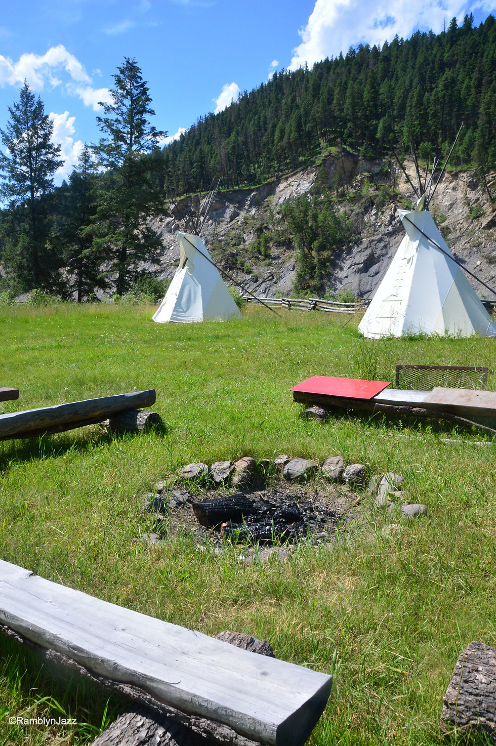
The view of the village was spectacular. I could see a couple of tipis, some pit-houses, and several other structures on a flat field beside the Fraser River.
I thought about the pitted, wet, mud & gravel road I had just travelled and considered the wisdom of continuing. It did appear to have more gravel than dirt on the section I could see. I suddenly realized that I had no idea if it was even open to visitors. Many seasonal businesses don’t open until July 1st in this area and many others do not plan to reopen after two years of closures.

I might drive this single-vehicle steep, gravel road and not even be able to enter. Of course, Wanda and I carried on down the hill, hoping that we wouldn’t encounter any traffic coming up the hill because there was literally nowhere to pull over. About halfway down I was delighted when a bear cub peeked out of the bushes and ran across the road. I stopped in case Mama came after but I guess she was hiding until I passed.

I parked beside the closed office and made my way to the site where I met the caretaker who was weed-whacking the tall grass, preparing for official opening on the weekend. During the month of June, most visitors are school groups on field trips. We had a lovely chat as she explained some of what I should see and a brief explanation of the Soda Creek Band and her family connection to the care and conservation of this site.

The Xat'sull (hat-sooth) Nation is a member of the Sepwépemc Great Nation. As stewards of one of the largest areas of the BC Interior, they had many contacts with neighbouring nations as they lived a life of hunting and gathering. Their lives were lived in family groups centred on the Fraser River and salmon.

I was urged to visit the path to the river before the sun was at a certain point in the sky and decided that would be the first direction I would head. Along the path was this incredible petroglyph. She was right, later in the day, it would have been more of a challenge to see.

I continued to follow the path to the river and scrambled glorifying in the rush of the water and the beautiful rock formations which created little pools of slow, shallow water that would be perfect for bathing, washing clothes, or for fish traps.

In this area, the native peoples did not use tipis. These tipis were donated by a First Nations community in Alberta to help demonstrate the differences. These tipis can also be rented for anyone who wishes to stay on site.
The Xat'sull built pit lodges and houses. These pit houses would last about ten years. The ground is partially hollowed out and then a roof structure was built and fitted to the hole. The hill is then built up around the structure for insulation.

Inside the lodge it would be cozy with a warm fire. The opening in the roof allowed the smoke out and hunters could climb the center ladder log to look outside and see what the animals were doing.

It was a hot day and the sky started rumbling with approaching thunderstorms. I thought it wise to get on the steep mud road before the rains hit. I hit the pavement of the highway just as the thunder cracked!

This was a special and unexpected stop and I'm very glad I took the road. I would love to visit during their busy time (although how that road is negotiated by several vehicles is a mystery) when they have demonstrations and full tours available.
Thanks for meandering with me. Share your thoughts, comments, or questions in the comments section. Send the link to a friend who would enjoy the blog. Become a member to get notification of new content, access to our members' only forum and a monthly newsletter full of chatty behind-the-scenes news, useful travel links and hints, plus more!
Comments